Scientists do not always account for mosses, simple, small and ubiquitous plants in their climate models, even though doing so could help us better understand climate change.
Most plants are “vascular”. This means they can control the water entering or leaving their tissues via stomata, tiny pores in leaves and, sometimes, stems that allow gasses to enter and exit the plant. Mosses, however, have no stomata.
The goal of Rose Lefebvre’s Master’s research is to include mosses as a vegetation type in Environment and Climate Change Canada’s Canadian Land Surface Scheme Including Biogeochemical Cycles climate model – called CLASSIC for short.
Rose is a student at the Université de Montréal under the supervision of Dr. Oliver Sonnentag (Université de Montréal) and Dr. Joe Melton (Environment and Climate Change Canada). Her research focuses on using the Canadian Land Surface Scheme including Biogeochemical Cycles model (CLASSIC) to reproduce the climatological conditions at Scotty Creek, in the Northwest Territories.
Posted: June 15, 2022 Anticipated start: January or September 2023 (flexible) Supervisory team: Trevor Lantz
Permafrost landscapes are undergoing rapid transformation, impacting infrastructure, hydrology, vegetation, and local livelihoods. In many regions the rate of change is so rapid that maintaining accurate inventories of permafrost disturbances presents a significant challenge.
This MSc project focusses on developing a protocol that will enable individuals such as park rangers, highway inspectors, hunters, and utility maintenance crews to record observations of anomalous conditions. The first part of this project will involve a review of existing observer-based networks and their suitability for qualitatively documenting permafrost conditions. The results of this review will be used to design a pilot protocol and web-reporting interface for recording anomalous permafrost conditions.
Interested applicants should hold an undergraduate degree in geography, environmental science, or a related field, and have a solid foundation in geomatics. Applicants must be self-motivated, have strong communication skills, the ability to manage multiple tasks, and be willing to travel to remote locations, potentially for extended periods. Preference will be given to students with previous experience working in northern communities and a background in GIS.
Stipend funding of $21,000 per year is guaranteed for two years, and support for travel to communities in the Western Canadian Arctic is also in place.
For more information on this project, please contact tlantz@uvic.ca.
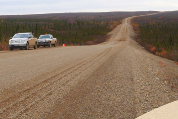
Permafrost is changing as Earth’s climate warms. Across northern Canada, the effects are already apparent: slow-moving landslides threaten highways, buildings are sinking and collapsing, and traditional food sources are threatened. The annual cost of permafrost thaw in the Northwest Territories has been estimated at $51 million.
Because permafrost occurs underground, data about permafrost are difficult and costly to collect. Once they’ve drilled a borehole, scientists insert instruments to record ground temperatures at regular intervals, sometimes collecting measurements every hour. This is exactly the kind of information permafrost modellers need. However, once these data have been used for a particular experiment, they might not be shared in a way that is easily accessible for other researchers. In fact, they may not be shared at all.
In Whitehorse, Panya Lipovsky, a surficial geologist with the Yukon Geological Survey, has been working to create a permafrost database for the Yukon. The effort is part of a Canada-wide trend to make historic permafrost datasets more available.
Nick Brown is the NSERC PermafrostNet data scientist, where he develops tools to support permafrost simulation and data handling and also promotes the adoption of standards for permafrost data
“So, it’s frozen mud?” my roommate asks when I try to explain my research topic to him. Since starting his own research in quantum physics, he has mastered the art of simple idioms. Perks of the trade, I suppose.
This frozen mud, however, covers half of Canada’s land mass. It is the soil on which many Indigenous communities are built, and it is thawing at alarming rates. With northern latitudes warming twice as fast as the rest of the world, scientists are racing to understand permafrost dynamics. Having this knowledge can help us ensure that Canada is equipped to face the coming climate crisis………..
Charles is a student at the Université de Montréal under the supervision of Dr. Oliver Sonnentag (Université de Montréal) and Dr. Joe Melton (Environment and Climate Change Canada). His research aims to reduce uncertainty in predicted soil carbon dynamics.
Collaborative solutions like the ones developed by NSERC PermafrostNet represent a shift toward a new generation of researchers who approach problems in a holistic way.
Read more about the permafrost research being conducted at Carleton University in this 3 minute article.
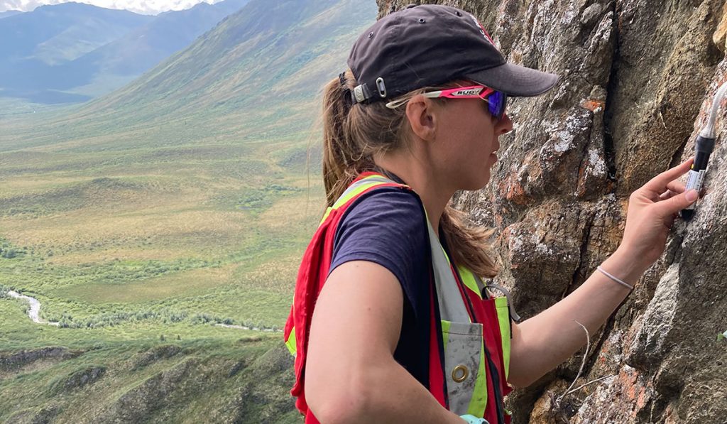
Galina, Hannah, Emilie and Stephan spent a couple of weeks in Yellowknife, Northwest Territories (NWT), reading out data and exchanging ground and rock temperature loggers, soil moisture sensors and tilt loggers for measuring ground subsidence. A highlight was using a metal detector to find temperature loggers hiding just below the ground surface, installed nearly five years ago. In mid-August, we hopped on a floatplane heading to KDI, an exploration camp, approximately 300 km northeast of Yellowknife. Here, we read out and exchanged loggers for a network of around 80 soil and 10 rock near surface temperature loggers, and 12 thermistor strings installed in boreholes. We spent our days in the field and our evenings back at camp organizing the collected data, soldering new batteries into loggers and of course enjoying the camp cook’s wonderful food.
Going out in the field this summer and collecting data from a number of different locations offered us valuable learning opportunities. We experienced periglacial features in person; jumping across the wet troughs of ice-wedge polygons, enjoying the easy walking of an esker, and using the edge of a solifluction lobe as a seat. We became acquainted with the different types of tundra vegetation, learning to identify common northern plants like dwarf birch and to recognize Labrador tea by its earthy smell. We are now especially well versed in the identification of cloudberries and blueberries, yum yum! The fluffy mosses were a favourite stop for well-deserved naps whereas the thick willows teeming with black flies were an unpopular route choice. On our third day at KDI, we were met by a large muskox herd, roaming the vast rolling landscape, seemingly unbothered by our presence. It was a fascinating sight! A lone curious muskox did however follow us around at a distance, causing us to reschedule some of our maintenance work.
The data we collected in the field will support a number of research projects in NSERC PermafrostNet. Ground temperature data will be used to test permafrost models and give insight into permafrost changes in the Canadian North, supplementing the data that we have available from Lac de Gras, NWT.
Successful fieldwork wouldn’t be possible without the amazing support of northern organizations such as the Northwest Territories Geological Survey (NTGS), Aurora Geosciences and Kennedy Diamonds Inc. (KDI). The NTGS was welcoming and allowed us to use their office as a home base for storage and essential equipment servicing, and gave us the chance to learn from local employees. The staff at the KDI camp was always accommodating and supportive of our work.
We would like to acknowledge our fieldwork activities took place in Chief Drygeese territory. From time immemorial, it has been the traditional land of the Yellowknives Dene First Nation, and more recently, the homeland of the North Slave Métis Alliance. We respect the histories, languages, and cultures of First Nations, Métis, Inuit, and all First Peoples of Canada, whose presence continues to enrich our vibrant community.
“Climate change follows from increases in the atmospheric concentration of greenhouse gases (GHGs) such as carbon dioxide and methane. The concentration of these gases in the atmosphere was about 280 parts per million (ppm) before the Industrial Revolution and rose to 315 ppm by 1958. The value is now 418 ppm. There is no prospect of this concentration declining in the next 1,000 years, and it may well increase substantially before it stabilizes. It will take several decades to establish a carbon-neutral economy. Effective adaptation is going to be important if we are to maintain functioning overland transportation infrastructure, especially in permafrost regions.”
Christopher Burn, Carleton University
In practical terms, the climate change we are experiencing is irreversible. Now, a collection of 61 reports concerning the changing permafrost environment have been submitted to Transport Canada and expertly summarized in an important compendium.
The Northern Transportation Adaptation Initiative (NTAI) is a federal program designed to increase the capacity to adapt to climate change. Since 2011, NTAI has supported a wide range of research projects associated with highways and airports in northern Canada.
The compendium provides a comprehensive overview of permafrost research projects supported by the NTAI program from 2011 to 2021. The reports have been summarized and organized to provide convenient access to permafrost knowledge gained over the last decade. This an extremely important collection of research for the scientific and engineering communities, governments, industries, policy makers, students, and general public.
“Ground ice maps will ever only be as good as the data behind them.”
Michel Paquette, NSERC PermafrostNet Post-doctoral Fellow, Université de Montréal
Appel aux évaluations d’experts !
Nous cherchons à obtenir les commentaires et la validation des experts de la communauté canadienne du pergélisol sur la récente carte de la glace de sol du Canada.
La carte des conditions de la glace de sol (ground ice map of Canada – GIMC) (Geological Survey of Canada, Open File 8713) présente une nouvelle cartographie à l’échelle nationale des conditions de glace de sol au Canada. L’évaluation du GIMC s’inscrit dans le cadre des efforts continus visant à fournir un retour d’information général et à évaluer des domaines spécifiques du GIMC, ce qui contribuera à la production de la première version de la carte de base du potentiel de glace de sol et des conditions géotechniques du pergélisol au Canada (GRIPv1) par PermafrostNet du CRSNG. Nous aimerions connaître votre avis d’expert sur l’exactitude de la GIMC actuelle. Votre expertise est précieuse, car les connaissances sur la glace de sol sont plutôt rares; elles dépendent fortement des connaissances du terrain et sont donc dispersées dans toute la communauté du pergélisol.
Nous aimerions connaître votre avis d’expert. Veuillez visiter notre page web pour plus d’informations et pour accéder à notre questionnaire – GIMC page web.
Call for expert evaluations!
We are looking to get expert feedback and validation from the Canadian permafrost community on the recent ground ice map of Canada.
The Ground Ice Map of Canada (GIMC) (Geological Survey of Canada, Open File 8713) presents new national-scale mapping of ground ice conditions in Canada. Evaluation of the GIMC is part of the ongoing efforts to provide general feedback, and evaluate specific areas of the GIMC, which will inform the production of the first version of the Ground Ice Potential and geotechnical permafrost base map of Canada (GRIPv1) by NSERC PermafrostNet.
We would like expert opinions on the accuracy of the current GIMC. Expertise is highly valued, as knowledge on ground ice is quite rare and highly site dependent, and therefore scattered all across the permafrost community.
Posted: February 28, 2023 Anticipated start: Application review will begin on April 1, 2023, but submissions will be accepted until a suitable candidate is found. Supervisory team: Trevor Lantz (University of Victoria) and Stephan Gruber (Carleton University)
NSERC PermafrostNet is seeking a postdoctoral researcher to develop a framework for permafrost terrain types that will support the analysis and prediction of permafrost change at multiple scales.
The utility of a permafrost terrain type approach will be demonstrated in Canadian permafrost landscapes using a variety of existing data sources (surficial geology, soils, topography, vegetation cover, ground ice, climate, and surface water). The successful applicant will also be encouraged to develop collaborative projects across the network.
We welcome applications from researchers from a range of disciplines including, but not limited to: permafrost science, landscape ecology, geomatics, physical geography, and geology.
This is a two-year position with an opportunity for a one-year extension. This position is based at the University of Victoria, and will also involve travel to work with our partners and with the group at Carleton University.
The annual stipend for this position is $58,000 plus benefits. Support for travel to conferences is available for the duration of the project.
The University of Victoria and NSERC PermafrostNet are strongly committed to fostering diversity as a source of excellence, cultural enrichment, and social strength. We welcome those who would contribute to further diversification including, but not limited to women; visible minorities; First Nations, Inuit and Métis peoples; persons with disabilities; and persons of any sexual orientation or gender identity and expressions.
To apply, please send a letter describing your qualifications and specific interests, a complete CV, and the contact information of three references to Dr. Trevor Lantz (tlantz@uvic.ca). Questions can be directed to Dr. Trevor Lantz or Dr. Stephan Gruber (Stephan.Gruber@carleton.ca).
“The NTAI’s focus on climate change was distinctive and forward looking at the time. Now it is recognised as integral to long-term management of transportation infrastructure.”
Christopher Burn, Carleton University
Transport Canada’s Northern Transportation Adaptation Initiative (NTAI) is the first organized national program in Canada to address northern transportation infrastructure stability in anticipation of climate change. From 2011 to 2021, NTAI has helped northern agencies to prepare for challenges anticipated from climate change for transportation infrastructure built in the permafrost environment.
The NTAI contributed to several important developments in our understanding of climate change impacts on infrastructure and potential strategies to manage these effects. When the NTAI was conceived, the primary risk to the transportation network was considered to be from thawing and loss of embankment integrity. The research conducted through the program identified a range of other geohazards, especially derived from a more active hydrologic regime and from thermokarst development close to infrastructure.
Following the 2021 NTAI Annual Network Meeting Emma Stockton, Christopher Burn and Jen Humphries have compiled a special 24 page report on Transport Canada’s NTAI Program. You can download the report here.
“The NTAI has played a unique role in Transport Canada’s climate change agenda, influencing the way the department designs and implements programs, and helping to inform funding decisions. Northern jurisdictions own much of the transportation infrastructure in Arctic regions, and their active involvement in this program has helped target permafrost research to areas of most pressing need, ensuring the program’s continued relevance. Overall, the NTAI is a great example of how research/industry/government collaboration can drive policy change and action to enhance the climate resilience of transportation systems in Canada’s permafrost regions.”
Maxine Bilodeau, Director of Climate Change Adaptation & Planning for Transport Canada